When I travel for work, running is my way of knowing the place. It doesn’t allow me to visit museums, or stop for lunch at a nice restaurant, but it is a great way to do some sightseeing. In April I had a conference in Phuket and a seminar to present in Singapore and I thought that running in one of these locations would be a good idea. My original plan was to run in Singapore because it would be much easier to fit my schedule. However, when I knew that the social program for the conference (there is always one…) would be a boat trip that I had done before, that opened an opportunity to run in Phuket.
This time my family travelled with me and every night they would share photos and stories of the places they’d visited. That settled it! I decided to run in Phuket and visit as many places as possible during my marathon.
The final course wasn’t decided until two days before the run. The main reason was that I made a promise on Facebook that the distance for my run would increase with the donations in my Can Too fundraising page: 47km for $4700, 49km for $4900, and so on… The night before the run I had reached $5020 in donations, plus a misplaced $200 donation from my sister-in-law that went through the main Can Too donation page instead of mine. It didn’t matter, it went to the right cause and I had to run 52km.
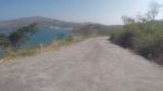
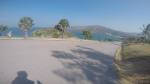
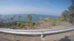
Here is the map that I came up with:
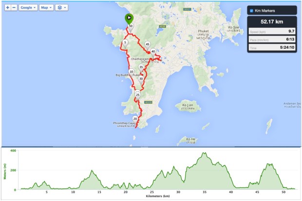
Planned course for marathon 11: nice sightseeing and nasty hills. The interactive course can be accessed here.
I would start from Patong Beach and head south passing by beaches, elephant camps, Phromthep Cape, some forest, Big Buddha, Chaithararam Temple, cross again the forest and finish back at Patong. Or so I thought…
Marathon day
I woke up, left the girls sleeping in the hotel room and met with Joe downstairs. He had already secured his record as the person that ran the most kilometers with me in my marathons and also the person with most appearances (marathons 3, 6 and 9), but he decided to go for a few more km and put his name on marathon 11 as well. Joe didn’t run for long as he had the boat to catch. He wished me good luck and left me as I started the first climb of the day.
It was a short climb, two small peaks in 2.5 km, without much to see and with very little space between me and the cars. Luckily there weren’t many at that time of the day.


Going down I reached Karon beach and was welcomed by a sign sponsored by 7eleven (I didn’t know at that time but 7eleven and FamilyMart would be the most sought after places during the marathon). I made a small detour just to check the beach. There were lots of people dressed in white in what seemed to be a religious ceremony. It reminded me of the offers that are made to Yemanjá on New Year’s Eve in Brazil. Add this to the hot and humid weather and it made me feel at home. From there to Kata beach it was an easy flat run, just made a bit hard by the heat. A few kilometers down the track and I made my first stop to buy fluids: a bottle of water to throw on my head and a bottle of sports drink to help with the hydration.


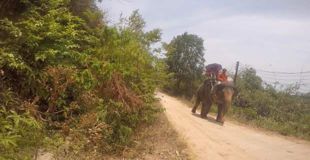
After that came the first real hill: 2.5km finishing up at the Karon view point at 193m. Despite the heat, I actually enjoyed the hill. Spotting a road sign reminding you that elephants are around, similar to our kangaroo signs here in Australia, and seeing the first elephants did help.


From there it was an enjoyable downhill with elephants on both sides of the road. Fast downhill with distracting views? A recipe for disaster as I missed a right turn. It didn’t take long to realise that I was off course. I decided that climbing a kilometer back wasn’t an option and that finding my way back wouldn’t be too hard. I looked at the map in my watch and took the next right turn going through an unsealed road. Again elephants, now with more space to roam, which made me be more cautious. I kept following a direction that would lead me back to the original course and started going up an extremely steep climb that led to… nowhere. A dead end! I went back down, passed by the elephants and joined the main road again.
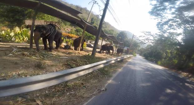
The big fellows
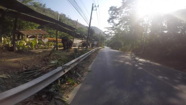
Elephants everywhere

More of the same 😉

More common than elephants are the places that sell gasoline by the bottle. This one was a more sophisticated version that had an actual pump.
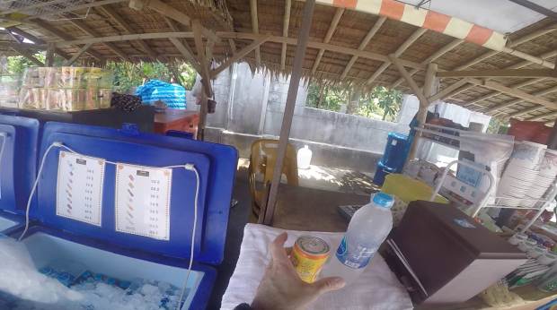
A mistake like this so early in the run (it happened around km 16) could made me run much further and could require a serious change in my course. That was the first blow to my morale and also the point where I started to feel the heat. I had been drinking from my camel back but hadn’t seen a single shop for the past 5 km and I started to worry about my fluids supply. I kept following the main road and came across a sign pointing to the direction to my next sightseeing stop: Phromthep Cape. I regained my confidence on the path chosen but the heat was brutal. I made my second stop at a 7eleven and took my time just to enjoy the air-conditioning inside. Another bottle of water and this time a bottle of ice tea.
I reached Phromthep Cape after 22.5 km and it was worth it. What a great view from the south of the island! Another stop at the shop and because I was at a major touristic spot, I had to pay four times what I had been paying so far for water. I didn’t mind because at that stage I was having trouble cooling down.
-
- View from Phromthep Cape
-

- View from Phromthep Cape
-
- View from Phromthep Cape
-
- View from Phromthep Cape
-

- View from Phromthep Cape
-
- View from Phromthep Cape
I was back to my course and had run only 2.5 km more than what was originally planned. Not bad. Running down from the cape with the blue sea on the left was amazing. The kind of view that reinvigorates you and lifts your spirit, and believe me, I needed that badly at that point. At the bottom of the descent I reached the beautiful little Yanui beach where I dipped my head in sea water just to refresh a little.

Refreshing at Yanui beach
A quick climb after the beach and I then another flat segment. At km 26 I ran past a woman that was watering the plants with a hose. I didn’t hesitate and asked, with hand signs, if I could have some water thrown on my head. She smiled and poured the much needed water over me. I joined the palms of my hands together and bowed my head to thank for those few seconds of pure joy!

Please, please!
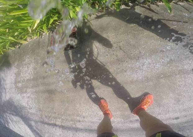
Oh! That’s gooood.
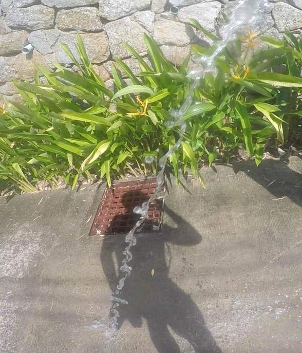
Is my shadow trying to drink it?
Further down the road and my second problem with the course. My watch started vibrating, indicating that I went off course. This time I decided to turn back and find my way. Unfortunately the left turn in my original plan was through a private property. I put my best innocent-tourist-that-doesn’t-know-where-he’s-going face but was stopped by the person taking care of a boom gate. Back to the main road and I found myself not only stopping for water, but also to ask for directions. A few kilometers later, at the 29km mark, and another stop. This time a bag of banana chips to go with the water and the ice tea and the question: “What is the direction to the Big Buddha?” I asked this question two times in less than 50 meters and the answers, accompanied by faces of incredulity, were the same: “too far sir, too far”. In my third attempt a bit more success: “You can go right but it is too far, 20km.” What about left?, I asked. “Works too, but also far”, she replied. I chose left, simply because it looked like I could get back on track from the map on my watch.
I was right. I got back on the road where I came from and should find my way to the next touristic stop: the Big Buddha. The downhill that made me miss that right turn at km 16, turned into a gruelling climb at km 31. I was struggling when I passed again by the elephants but manage to get to the Karon point view again with minimal walking. There I bought a big bottle of water to fill my camel back and also scored a big piece of ice with the lady from the stall.
I kept following the road but, as I began the descent, I started to doubt that I was in the right path. I vaguely remembered a right turn to the Big Buddha in the original map. However, since my watch hadn’t vibrated to tell me that I was lost, I kept going. A while later I decided to stop and check the map again just to realise that my watch had lost contact with the satellites and had frozen at km 32. Not only I had lost track of how much I had run, but even worse, I didn’t have a map anymore!
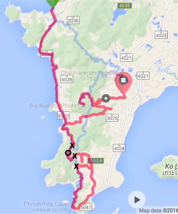
Final map of the run (red) superimposed with the original plan (light blue). The X indicate missed turns, while the circle shows the point where the watch stopped working. This map was obtained by combining the Garmin data before it died with the Strava files. I edited the gpx file to include the gap between these files. All details and stats are available here.
I got my mobile from my backpack and turned Google maps to tell me where to go, and Strava to count the kilometers. I was so pleased that I had bought a Thai SIM card the day before together with a power bank for the mobile. The first made the mobile useful while the second made it last for the whole run. I had missed another turn but it was not my fault, the watch had stopped before that.
On my way to the Big Buddha I took a busy and wide road. There was no shade to protect me from the sun and, given the traffic, I found it a bit dangerous. There was no option though, I had to keep going. At km 40 I finally start my climb to the Big Buddha (remember that I didn’t know this number by then, all I knew was that I had run 32km+some unknown distance+whatever Strava was showing to me). I was finally free from roads and found myself running along a narrow trail. However, it didn’t take long for the trail to become a dirty road and for more elephants to show up.

Trail to the Big Buddha
Here they are again

Yet another one…
When the trail ended, I found myself on the steep main road to the top and couldn’t do much but walk. I was extremely tired and couldn’t find energy to run. I stopped at a restaurant to buy more water and had my second energy bar but that wasn’t enough. Those 5km took an eternity to end but eventually it did end and I arrived at the top.


The Big Buddha is really impressive but all I wanted at that moment was another bottle of water.
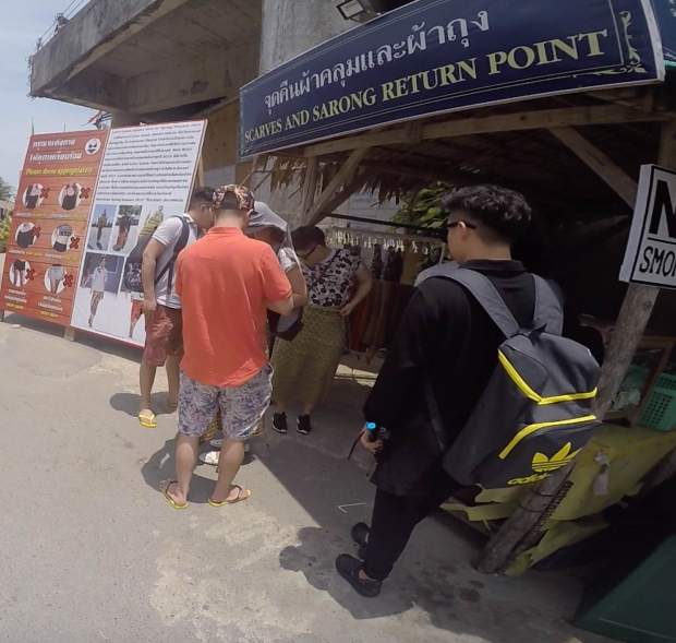
Apparently my sweaty Lycra was OK, but women need to cover a bit more. Go figure…
Water, my precious.

So good to be up there.

Hello Big Buddha!
I stopped up there for a long time. I called the girls at the hotel to tell that I was very late but alive and well. I was exhausted and emotional. I checked my Facebook and saw amazing messages of support from my friends and I had tears in my eyes.Thank you! Every single word helped a lot at that point. I then started to think about more practical things and checked the maps to see how far I had run and how much I needed to complete the promised 52km. I couldn’t figure out exactly the distance covered so far, but Google maps was giving me another 15km to get back to the hotel and that would definitely be too much. I decided to run down the road that I had just climbed and take a taxi back to the hotel. After the long break I was feeling much better and ran quite comfortably not only the downhill, but also the flat that soon followed.
I couldn’t find a taxi and ended up taking a ride in a moto-taxi back to the hotel. Why not finish the day with the thrill of a moto ride with a Phuket driver? Well, I actually didn’t think about any of this, I just wanted to get back. At the hotel lobby, Marcele and Pauline were waiting for me. They spent an hour trying to buy flowers but all they could get was the little flower in the photos picked from the hotel garden. A lovely reception!

With Pauline and Cele at the hotel.
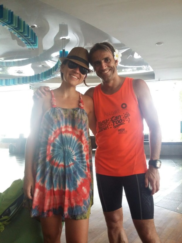
A good looking couple in Phuket 😉
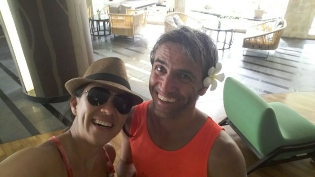
Happy!
In the end I ran 51.94km according to the map that I reconstructed from the data in my Garmin, the Strava files on my phone, and by filling in the gap between the two. I owe one kilometer but I’ll pay with interests in marathon 12: the Great Ocean Road Ultra Marathon. Only two weeks to go and a bit over $700 to reach my fundrasing goal of $6000. It is the final stretch, help me get there by donating to Can Too (https://www.cantoo.org.au/fundraisers/AndreCarvalho).
