Yesterday I left Canberra on my way to a workshop in Benasque, a small Spanish village at the Pyrenees. In the past 24 hours I have watched three movies, read a book, worked on a grant proposal rejoinder, eaten four airplane meals, and slept for a few hours. The problem? I’m still in an airplane!
I also watched a couple of sports documentaries: one about the 2015 Dubai marathon, and another about the Austrian cyclist Gerhard Gulewicz and his breathtaking attempts to win the Race Across America (RAAM). This reminded me that I have an extra reason, besides science, to be excited about this workshop. As you may have read in this post, Benasque is the place I chose to run the first marathon of my fundraising challenge. Since I have some time to spare before I’m asked “lamb or chicken” and before we land in Barcelona, I thought it was a good time to write a marathon preview.
I always knew that planning a marathon in Benasque would be challenging. There is no way to avoid the mountains. Of course you can limit the amount of climb by designing a course with multiple laps along a less hilly loop, but that would be no fun, would it? I studied some maps from the Wikiloc website and used my previous limited knowledge of the region to design a course. I was tempted to go to the lakes that I showed here, but that would involve some steep hiking over rocks rather than running, so I ditched it. Instead, I went with this* (similar to what I described here):
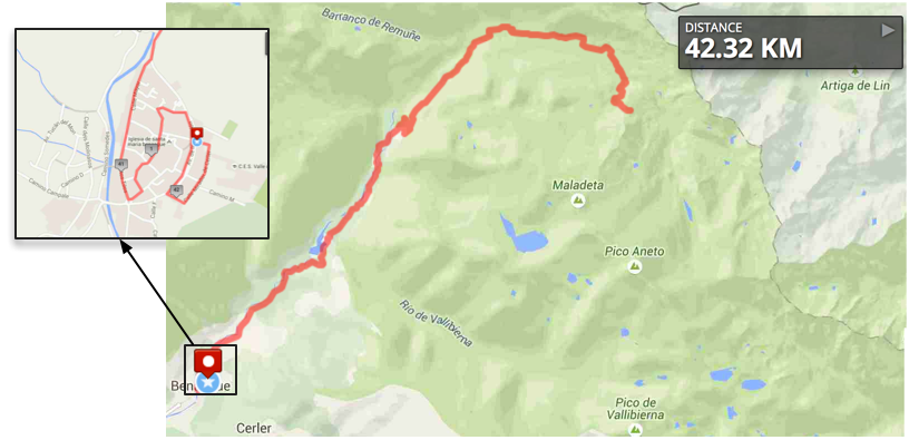
Course map for the first marathon. You can find the details at: http://www.mapmyrun.com/routes/fullscreen/747602475/
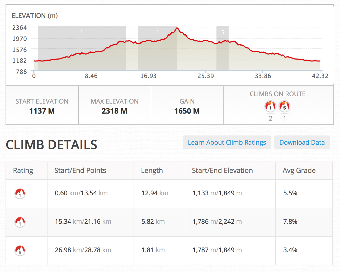
You certainly noticed the long way up, 1650 m of elevation gain, with two category 1 and one category 5 climbs. Sounds very hard but you know what they say: the more impressive your challenge, the better your chances of a successful fundraising. You may have also noticed the ridiculous maze-like beginning, included just to reach the marathon distance. ‘Why not extend the course one more kilometer from the final point?’ – you may ask. Well, that final point was meticulously planned to be the highest point of that track. If I went a few hundred meters further, then I’d have a steep descent that would need to be climbed back. No, I didn’t want to make it any harder than already is.
To be honest, I don’t really know whether I can run that last bit or not. I’ve been on a bike for most of that course before, but the last climb from kilometer 18 to half-marathon mark is unknown to me. I guess I’ll have to check that on the day. I can always make up for the distance by running past Benasque and then coming back. But anyone that has had the chance to race in a course that you pass in front of the finishing line and still having a few kilometers to run knows that it is no fun.
By the way, I went for the lamb! 😉
* Since I published this post the course has been changed to make it easier for people to run parts of the marathon with me. The final map can be found here.


