Yesterday I left Canberra on my way to a workshop in Benasque, a small Spanish village at the Pyrenees. In the past 24 hours I have watched three movies, read a book, worked on a grant proposal rejoinder, eaten four airplane meals, and slept for a few hours. The problem? I’m still in an airplane!
I also watched a couple of sports documentaries: one about the 2015 Dubai marathon, and another about the Austrian cyclist Gerhard Gulewicz and his breathtaking attempts to win the Race Across America (RAAM). This reminded me that I have an extra reason, besides science, to be excited about this workshop. As you may have read in this post, Benasque is the place I chose to run the first marathon of my fundraising challenge. Since I have some time to spare before I’m asked “lamb or chicken” and before we land in Barcelona, I thought it was a good time to write a marathon preview.
I always knew that planning a marathon in Benasque would be challenging. There is no way to avoid the mountains. Of course you can limit the amount of climb by designing a course with multiple laps along a less hilly loop, but that would be no fun, would it? I studied some maps from the Wikiloc website and used my previous limited knowledge of the region to design a course. I was tempted to go to the lakes that I showed here, but that would involve some steep hiking over rocks rather than running, so I ditched it. Instead, I went with this* (similar to what I described here):
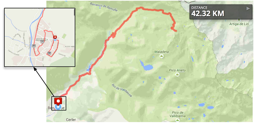
Course map for the first marathon. You can find the details at: http://www.mapmyrun.com/routes/fullscreen/747602475/
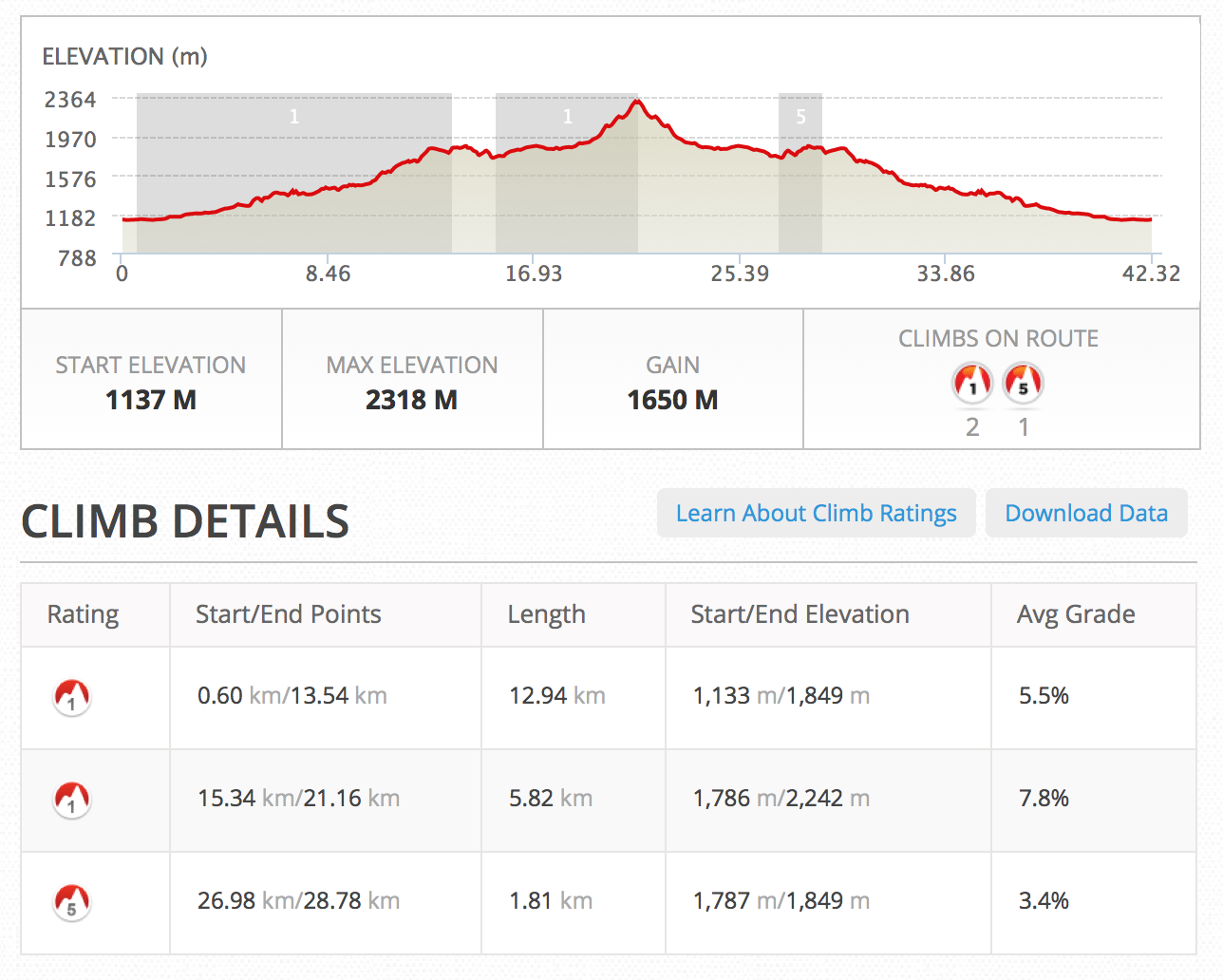
You certainly noticed the long way up, 1650 m of elevation gain, with two category 1 and one category 5 climbs. Sounds very hard but you know what they say: the more impressive your challenge, the better your chances of a successful fundraising. You may have also noticed the ridiculous maze-like beginning, included just to reach the marathon distance. ‘Why not extend the course one more kilometer from the final point?’ – you may ask. Well, that final point was meticulously planned to be the highest point of that track. If I went a few hundred meters further, then I’d have a steep descent that would need to be climbed back. No, I didn’t want to make it any harder than already is.
To be honest, I don’t really know whether I can run that last bit or not. I’ve been on a bike for most of that course before, but the last climb from kilometer 18 to half-marathon mark is unknown to me. I guess I’ll have to check that on the day. I can always make up for the distance by running past Benasque and then coming back. But anyone that has had the chance to race in a course that you pass in front of the finishing line and still having a few kilometers to run knows that it is no fun.
By the way, I went for the lamb! 😉
* Since I published this post the course has been changed to make it easier for people to run parts of the marathon with me. The final map can be found here.

One comment